The MiARD project has made a great deal of progress in refining the so-called ‘shape’ model of the comet, which is exactly what it sounds like – a mathematical representation of the shape of the comet, derived from photographs taken by the ROSETTA orbiter, together with navigational information. The example below shows the remarkable resolution now achieved.
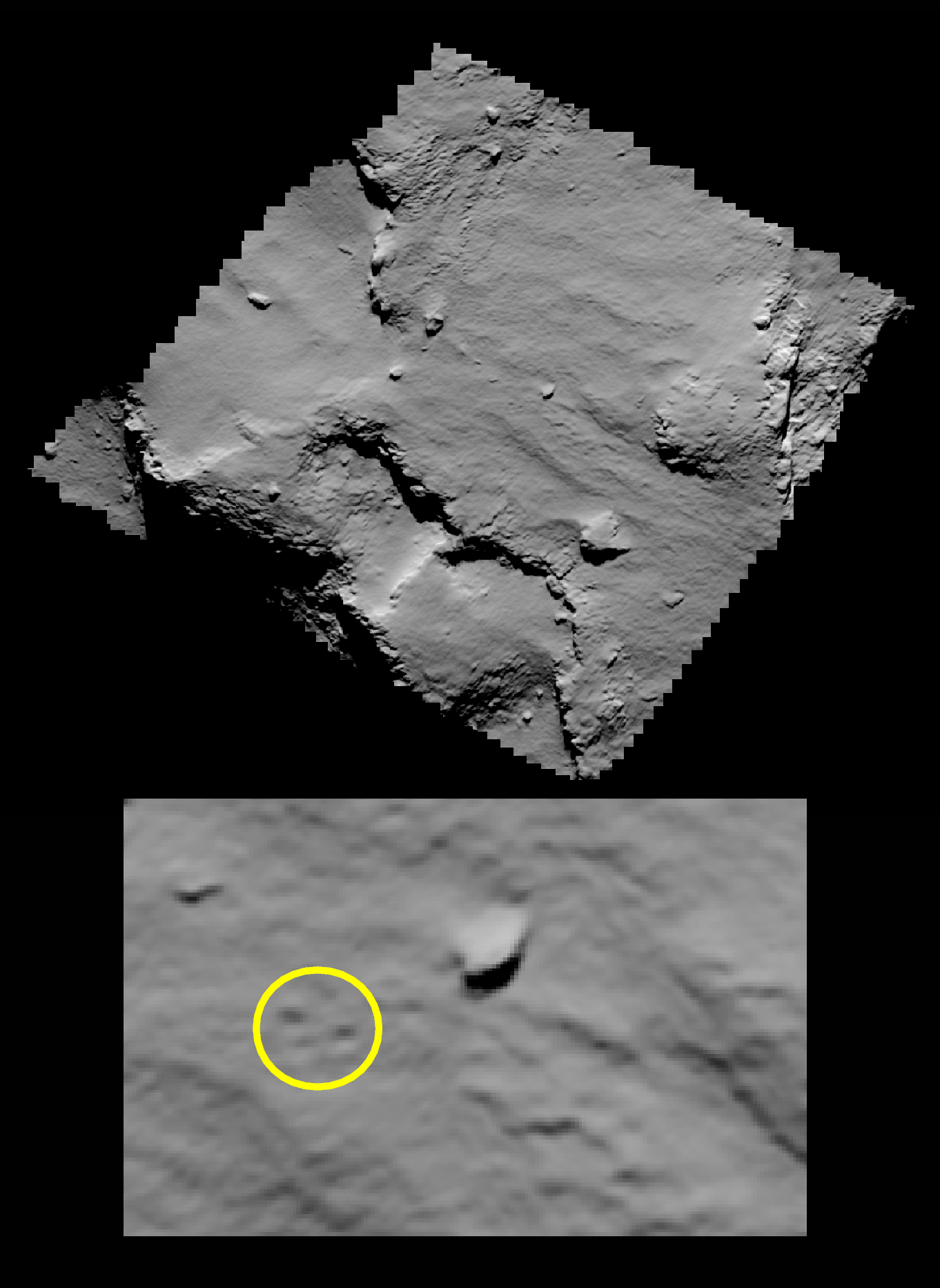
NEIGHBOURHOOD OF THE AGILKIA LANDING SITE
This picture shows a rendered view of a high-resolution local digital terrain
model of the region in Ma’at around the Agilkia landing site, at which Philae
touched down the surface of the comet for the first time on Nov 12, 2014 at
15:34 UTC.
The digital terrain model has been created in the frame of the MiARD project
with the “Multi-resolution Photoclinometry by Deformation” (MPCD) method
developed at Laboratoire d’Astrophysique de Marseille (CNRS, Aix-Marseille
University, France) using stereophotogrammetric data produced at the
German Aerospace Center (DLR, Berlin, Germany).
This view mimics the exact observing conditions of an image acquired by the
Narrow-Angle Camera onboard Rosetta on Nov 12, 2014 at 16:18 UTC, just after
the Philae touchdown. This image was acquired from a distance of about 15 km
above the surface, corresponding to a resolution of about 30 cm/pixel on
the image. The upper panel presents a global view of the DTM while the lower
panel is a zoom on the Agilkia landing site showing the footprints created by
Philae at the surface of the comet.
Fo rmore information, contact: laurent.jorda@lam.fr